5 HOBART WAY
Owner Information
TAYLOR ROBERT L. JR. & ANNMARIE
5 HOBART WAY
NORTH EASTON, MA 02356


Property Details
5 HOBART WAY is classified as a Single Family Residential (Split-level).
The primary structure on this property was built in 1999. There are 1,986ft2 of built area within this property. There is 1,139ft2 of residential/living space within this property. This property is listed as having 5 rooms.
5 HOBART WAY is valued at $467,100. The land is valued at $302,000 and the structures are valued at $165,100.
This property is in Zone RES. Confirm with local Zoning Board authorities to ensure there are no overlays or other easements on this property.
The most recent deed for 5 HOBART WAY is recorded at the local registrar in Book 25163, Page 300. 5 HOBART WAY was last sold on Thursday, June 20, 2019 for $100.
Assessment data from fiscal year 2022.
Flood Data
According to the FEMA National Flood Hazard Layer, this property does not appear to be in a flood zone. It may also be in an area not yet reviewed. Nonetheless, confirm this information prior to taking any action.
To view the flood hazards around this property, create a FEMA "Firmette" Map of the area around 5 HOBART WAY.
Broadband Internet Providers
| Provider | Type | Bandwidth (mbps) | |
|---|---|---|---|
| Crown Castle Fiber | Fiber | 0 | 0 |
| VSAT Systems, LLC. | Satellite | 2 | 1 |
| HughesNet | Satellite | 25 | 3 |
| GCI Communication Corp. | Satellite | 0 | 0 |
| Comcast | Cable | 1000 | 35 |
| Verizon New England Inc. | Fiber | 940 | 880 |
| Verizon New England Inc. | DSL | 7 | 0 |
| Viasat Inc | Satellite | 100 | 3 |
Broadband service provider data from December 2020.
Adjacent Properties
- 51 MAIN STREET
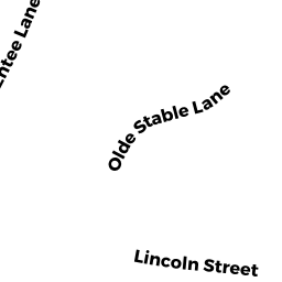
Libraries, Museums (Charitable Org.) owned by AMES FREE LIBRARY OF EASTON INC - 15 OLDE STABLE LANE
Single Family Residential owned by FARBER DAVID J & MICHAELA K TRUSTEES - 9 HOBART WAY
Developable Residential Land owned by TAYLOR ROBERT L JR - 5R HOBART WAY
Undevelopable Residential Land owned by TAYLOR ROBERT L JR